

Regardless of your hiking experience, hiking apps are essential for navigating, planning, or discovering new outdoor trails. Plus, they’re cheaper than standalone GPS units. But which app should you get? Here are the best hiking GPS apps available today.
Best Free Option: Cairn (iOS/Android)

Cairn is one of the best safety-oriented hiking GPS apps. Like other hiking apps, Cairn allows you to see, create, and follow trails (and even has offline maps). But it also has cell-coverage maps that can help you avoid dead-zones, live tracking that shows your location to friends, and automated messages to emergency contacts if you get lost.
The Cairn hiking app is totally free on iOS and Android, which is surprising when you consider its offline maps and unique safety features.
Best Premium Option: Gaia GPS (iOS/Android)

Gaia GPS is a premium outdoor app that’s perfect for hikers and campers. It’s a robust app that’s full of pre-existing road maps, off-road maps, topographic data, and live-weather info. It’s great for streamlining your next hike or creating a brand new hiking trail from scratch. You can even share or check out custom hiking trails by other Gaia users in your area.
Gaia GPS is a free app, but most users suggest upgrading to the paid version (upgrades are done in-app). Basic membership costs $20 a year and allows you to save maps for offline use, while Premium membership costs $40 a year and comes with custom Nat-Geo maps, U.S. hunting maps, and more.
For AR Experiences: ViewRanger (iOS/Android)
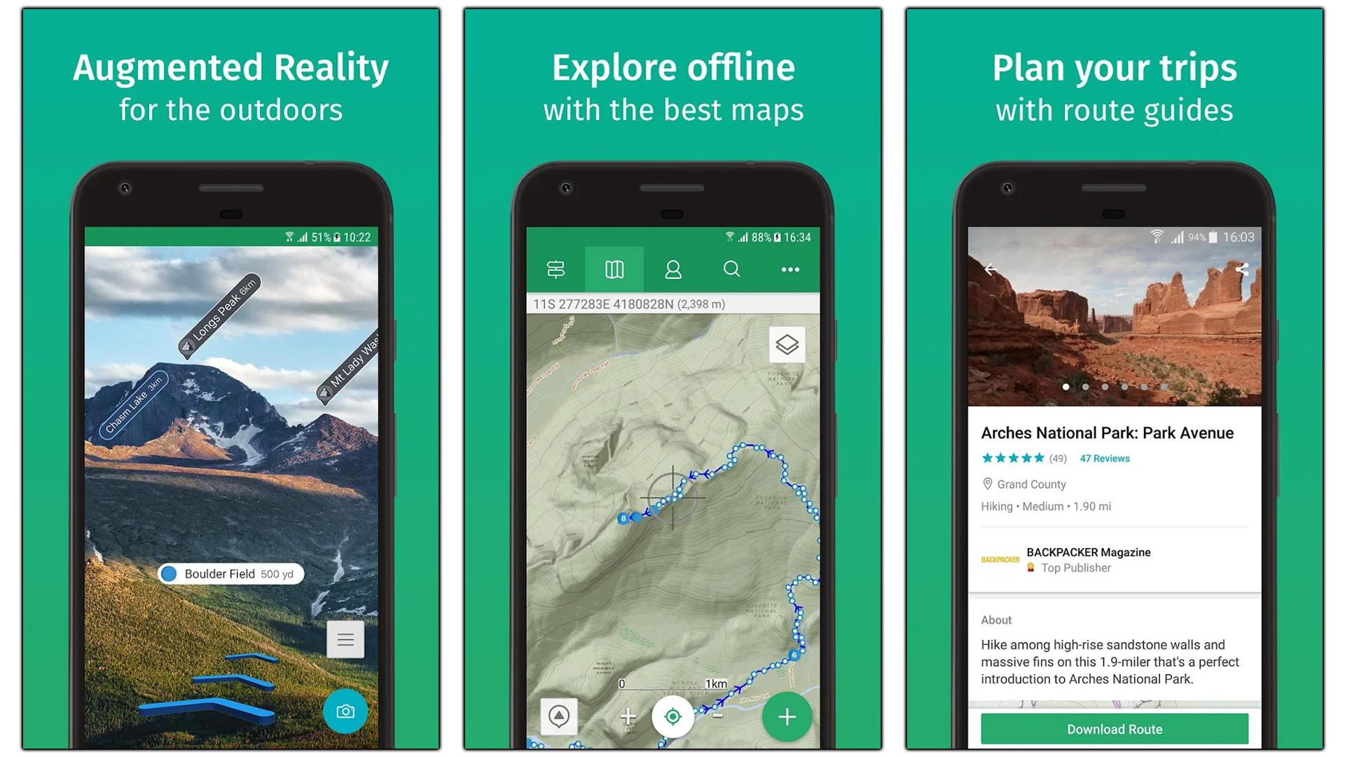
ViewRanger has just about everything you’d want from a hiking GPS app. Limited offline maps, trail planning, topographic info, and trail guides—all for free. The premium version is even more interesting. It offers unlimited offline maps, live-tracking for family and friends, and AR features for trail flyovers and mountain identification.
For Family Fun and Exercise: AllTrails (iOS/Android)

The AllTrails app is a great all-in-one outdoors app for hikers, runners, cyclists, and nature-enthusiasts. At a basic level, it’s a GPS app with pre-set maps and trails. These trails can be filtered for different families (dog-friendly, kid-friendly, wheelchair-friendly), or they can be filtered by distance and intensity. Over time, the app collects your hiking history and displays your progress in terms of mileage, speed, and calories burned.
AllTrails works well as a free app, but some Pro features (like offline maps, weather overlays, and emergency contacts) cost $30 a year.
For Hiking, Hunting, and Fishing: onX Hunt (iOS/Android)

onX Hunt is a premium hiking app with a serious emphasis on hunting. As a GPS app, onX Maps gives you access to hunting, hiking, and biking trails with topography info and live updates for weather. You can download the maps for offline use, and you can even view property boundaries and landowner names from the map.
Post a Comment Blogger Facebook
We welcome comments that add value to the discussion. We attempt to block comments that use offensive language or appear to be spam, and our editors frequently review the comments to ensure they are appropriate. As the comments are written and submitted by visitors of The Sheen Blog, they in no way represent the opinion of The Sheen Blog. Let's work together to keep the conversation civil.